What is GPS? Everything You Need to Know
Published by Ian Fortey in nauticalknowhow Last updated on August 22, 2021
Global positioning system GPS is a satellite-based navigation system. The GPS satellite system has completely changed the way humans navigate the globe. And its uses extended well beyond navigation. Search and rescue had changed for the better as a result as well.
Thanks to GPS, military users and civilians have access to an extensive satellite network. Information is available 24 hours a day. Accuracy was once bordering around 15 meters or about 49. By the year 2000, accuracy had been refined to 5 meters or about 16 feet. If you are using a receiver today that uses the L5 band, accuracy can be refined down to under one foot. All 24 satellites are scheduled to operate on the L5 band by 2027.
Let’s take a look at the history of GPS, its uses, and how it works.
What is GPS? Global Positioning System History
The global position system used in North America was started by the US Department of Defense. It dates all the way back to the first GPS satellite in 1973. Of course, there were no civilian GPS receivers back then. It did not become available to the general public until the 1980s. And even then, it was limited in scope. The system was not fully operational with all 24 satellites until 1995.
Ivan Getting, Gladys West, Brad Parkinson, and Roger Easton are credited with inventing GPS. It was definitely a group effort and a lot of technology was required, however. Many people contributed along the way to make it what it is.
The idea for GPS was indirectly thanks to Russian satellites. The US was tracking Russia’s Sputnik satellite. They discovered they could predict its movements based on the Doppler Effect. This was thanks to shifts in the radio signals it emitted. Further testing proved they could use this same technology to track the movement of subs.
Armed with this knowledge, the DoD set about creating a navigation system. This would also serve as a reliable tracking system. The first Navigation System with Timing and Ranging was formed. The NAVSTAR GPS satellite was launched in 1978.
In the present, GPS is operated by the United States Space Force. Because the government controls GPS, it’s worth noting they can also limit access. In fact, they did so in the 1990s to other countries, including India. This was during the Kargil War between India and Pakistan.
Because GPS is controlled by the US, other nations have developed their own systems. There are actually several global satellite systems in place currently. More are on the way as well. We’ll cover those shortly.
The Korean Air Lines Incident
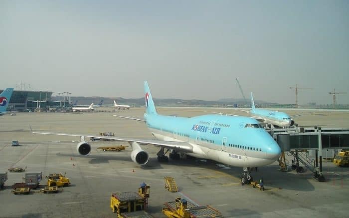
GPS became widely available to the public after one specific incident. On September 1, 1983, the flight was travelling from Anchorage, Alaska to Seoul, Korea. The plane deviated from its scheduled flight path and travelled into Russian airspace.
Soviet forces inaccurately identified the flight as a US spy plane. A US recon mission had recently been in the area, so the Soviets were on high alert. In addition, warning shots were fired, but it was determined the Korean flight likely did not see them. To the Soviets, this indicated a hostile intent. They fired missiles and destroyed the plane. A total of 269 passengers and crew died.
The Soviet Union denied the incident had occurred. Later, they admitted it but said it was a provocation to war. They also withheld valuable information, such as the salvaged black box, for over 10 years. It was arguably one of the closest moments we came to fully engaging in combat during the entire Cold War. But it did have an unexpected side effect.
As tense as this event was, the US and the Soviet Union did try to work together afterward. In the spirit of avoiding further tragedy, the GPS system was opened up. By executive order, President Ronald Reagan made it available for civilian use. No longer would it just be available for military purposes. The intent was to prevent any errors like the Korean flight from happening again. And as close as it brought us all to the brink of war, it really was caused by an error. An error that GPS could have and would have prevented.
What is a Global Navigation Satellite System?
This is often abbreviated to GNSS. That means Global Navigation Satellite System. It is a system of satellites in orbit. There are several global navigation satellite systems in the world. GPS is one of those systems and it runs on the United States’ network of satellites. There are others, however.
GLONASS: This is the Russian system. It stands for GLObal NAvigation Satellite System.
BDS or BeiDou: This is China’s BeiDou Navigation Satellite System.
Galileo: This is the system used by the European Union.
IRNSS: This is the Indian Regional Navigation Satellite System. It is not yet global but plans to become global soon.
Most people use GPS in a generic sense, the way you might call a tissue a Kleenex. That said, as we can see, GPS is a kind of GNSS. There is only one GPS, and it’s run by the US government. That said, there are several global navigation satellite systems around the world.
How GPS Satellites Work
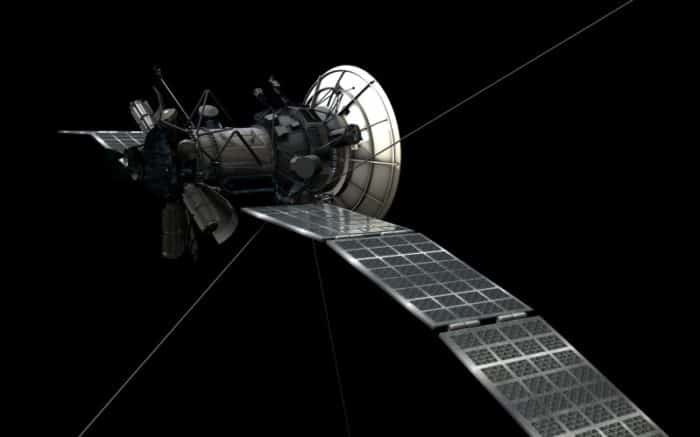
GPS satellites circle the earth two days every day. They do so in a precise orbit. Each of these transmits their unique satellite signals. These can be decoded by receivers to give an accurate location on the earth.
The 24 satellites are positioned in six orbital-planes. You can find them at 13,000 miles above the surface of the Earth. In images or videos, they look like they are barely moving at all. In fact, they are travelling at 8,700 miles per hour. This creates a kind of signal net or web around the planet.
You need data from at least four satellites for the system to function. If a device cannot get a signal from four satellites, that could be a problem. Four or more satellites will give the most accurate info possible. An accurate geographical position cannot be determined. You can technically just use data from three. Three satellites will give you a position. The fourth satellite is used as a kind of verification system. It ensures the accuracy of the first three and also helps in measuring altitude.
The satellite sends certain information to every receiver. This includes date and time and almanac data about the satellite.
GPS is able to help determine more than just a spot on a map. Speed and time information can also be calculated thanks to GPS. With all the information the satellites gather, a full picture can be formed. Of not just location but travel can be gathered. This is why GPS can tell you how long it will take you to travel from one place to another. It’s even able to make adjustments based on weather conditions. Traffic conditions can also be factored in to a certain extent.
The Segments of GPS
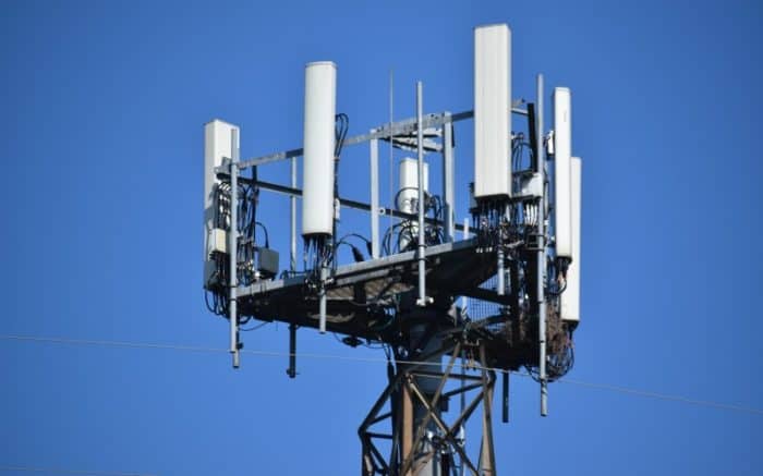
Just like your cell phone works with the help of towers that relay signals, GPS has parts. Each segment works with the others to create a functional system. There are three parts to this. That include the GPS receiver/transmitter, satellites and the control segment.
1.GPS Receiver Segment
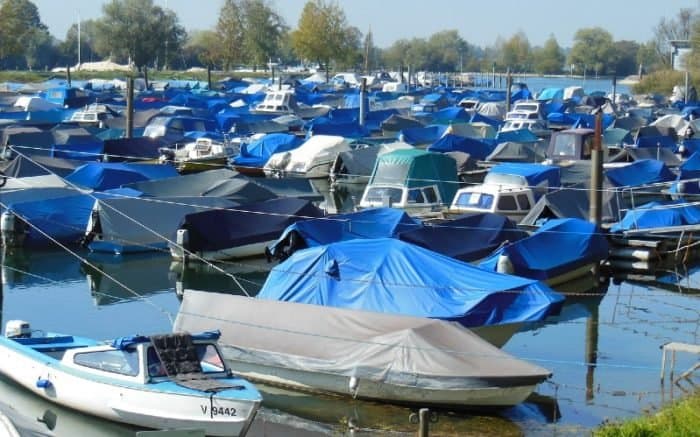
This is the end user segment of the system. Your phone or other GPS capable device is a receiver. This is what the Coast Guard would track to find you in an emergency if your fishing boat got lost at sea.
2.Satellite Segment
Sometimes called the GPS space segment. These are the devices that are in a low earth orbit. These satellites work on solar energy derived from solar panels. If there were some kind of solar eclipse, they do have backup batteries onboard to keep them running. The satellite transmits signals to determine geographical location. This data can then be determined by the GPS receiver. We’ll explain exactly how in just a second.
3.Control Segment
This is what runs the show on Earth. The control segment includes ground antenna and monitoring stations. These are what keep the satellites working. They also check the signals from the satellites. They exist all over the world.
How Does a GPS Satellite Track Things?
So it’s nice to say GPS satellites can pinpoint your position, but how? This part is often overlooked, and it’s pretty cool how they work.
As we said, three satellites are needed to triangulate a position. That makes sense when you consider what “triangulate” means. You need three points, just like a triangle. The fourth one, as we said, is for verification. More satellites will always equal a more accurate result.
So let’s make up an example. You turn on your GPS device and a satellite in orbit at a height of 10,000 miles picks you up. It does this by transmitting radio signals. That’s what a GPS satellite puts out. So that radio signal hits your receiver 10,000 miles away. But that doesn’t pinpoint you. Radio signals travel outward from the satellite in a sphere. You have just set a limit on that sphere of 10,000 miles. That’s pretty big, right? And as far as that one satellite knows, you can be anywhere on that sphere. We need more data.
A second satellite will also find you in its signal sphere. The signal sphere from the first satellite and the second satellite are going to overlap. Your location is now narrowed down to the place where those spheres meet. But it’s still a large area.
A third satellite is needed. That final signal sphere will narrow down your precise location. It is where the signals from all three satellites intersect. There are only two places where the signals will intersect in this scenario. One of these is going to be your true, absolute location. A fourth satellite can pinpoint it exactly. However, as we said, this isn’t technically necessary. One point will typically make sense while the other will not. The second point may not even be on the surface of the earth. The process of elimination is usually able to give the accurate location. But, as we said, a fourth satellite confirms, just to be safe.
In order for this to work, the speed of radio signals needs to be accurately measured. This is why the satellites have to be in a very precise orbit. If their location is exact, then you can tell where a receiver is. This is all based on how quickly the radio signal from the satellite is able to be received.
Luckily, GPS satellites use atomic clocks. These are the most accurate clocks in existence. They measure time based on the oscillations of a single atom. An atomic clock can be accurate to within 1/15,000,000,000 of a second per year. That;s why GPS can offer such precision in determining where something is.
The issue of satellite timing is actually a lot more in depth. This gives you the gist of how it works, however.
Three Types of GPS Signals
We mentioned satellites using the L5 band above. That implies the existence of different L bands. So what are those?
L1: This is the oldest kind of GPS signal. It’s broken into two codes known as the Coarse/Acquisition Code (C/A) and the Precision Code (P-code). P-code is military and does not concern us. The C/A code is what civilians use.
L1 operates at 1575.42 MHz. It’s the “old reliable” of GPS, but it’s relatively slow moving. It also doesn’t penetrate solid objects or obstacles well. In this case, obstacles aren’t just things like buildings. Cloud cover and trees can slow down L1.
L2: Like L1, this has both military and civilian applications. It operates on a frequency of 1227.60 MHz. That makes it faster than L1 and a bit more reliable. The L2 infrastructure relies on L1. For that reason, the two need to work in conjunction.
L5: There is no L3 or L4, in case you were wondering. L5 comes after L2. It operates at 1176 MHz and has only started coming into use in 2021. Initial uses are for things like emergency services and aviation. But civilian use is also one of the applications of L5. Because it is so limited in use, there isn’t a lot of data on L5. But given its remarkable speed and accuracy, it will be of great use in the future.
Other GPS Applications
So sure, a nice handheld GPS can show you where you are on a map. But the range of uses for GPS are remarkable.
GPS has been able to monitor movement on the Earth. Because satellites are monitoring the world, they’re able to record earthquake activity. That has enabled researchers to start noticing patterns. GPS can help determine the magnitude of an earthquake within moments of it starting. That lets researchers know how far it will be felt. In turn, that means cities can be warned before they even feel the quake reach them. And it’s not just earthquakes.
GPS is being used to help offer advanced warning for a number of natural disasters. In particular, things like volcanic eruptions and flash floods. Normally, these things happen with almost no warning whatsoever. GPS is able to offer precious minutes to those in affected areas to prepare or evacuate.
When a volcano is about to erupt, the surrounding ground will shift. Even small shifts are able to be measured by GPS stations around many volcanoes. That means scientists can sometimes tell days in advance of an eruption.
Depending on where you are in the world, GPS is being used for some amazing research. It has found applications as snow sensors in some parts. It can also serve as a tide gauge.
Data from cell phone GPS was used during the Covid-19 pandemic to help with contact tracing. This was done in an effort to stop the spread of the virus. It also helped monitor the way in which id was spreading.
GPS is blocked by changes in weather patterns. That has allowed researchers to use it to gauge how much rain is going to fall. It’s based on how moisture in the air affects signals. It’s pretty amazing stuff. But obviously not all of that affects you if you’re on a boat, for instance. So how does it help you?
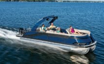
Do Boaters and Hikers Need GPS Receivers?
At the end of the day, not everyone wants to know how GPS systems work. Most people do want to know if they need it though. Is it worth using? And why? In a word, yes, you do need GPS. It’s an incredible tool that can really improve your experiences outdoors in many ways.
For boaters even more than anyone else, GPS is an amazing tool. Mankind literally spent centuries trying to refine their ability to navigate at sea. And some people today will discount this by saying that times change. Of course, it was harder to navigate 500 years ago. They didn’t have the same technology we do. Well, that’s the point. They didn’t have the technology we do. We have GPS. That literally changes the world.
Consider what would have happened a century ago if you were on a boat caught in a storm. That was it. You were at the mercy of nature. Maybe your wits and some luck could save you. But you were just as likely to never be seen again.
Even after radio was invented, the situation was still not a hopeful one. If you got into trouble at sea, you could call for help on your VHF radio. But what would you say? You’re three hours away from Miami? In what direction? How fast did you travel to get to where you are? How did the wind and current affect your travel? Finding a boat in danger was like finding a needle in a haystack.
Tens of thousands of lives have been saved by GPS technology. It allows a swift and accurate picture of a situation for emergency crews and rescue teams.
Even when there’s no emergency, GPS has more than proven its worth. Map data is helpful but can become easily outdated. GPS data provides real time information that can be of great use. Like we mentioned earlier, your car’s GPS can even alert you to accidents and speed traps. GPS at sea can help you find the best fishing spots. You can track down interesting coastal features and so on.
A boater can use GPS to record features they want to remember later. If you found a place where the fish are biting like crazy, just make it a waypoint on your GPS. You can come back to the exact spot anytime you like in the future. If there was a shoal, an inlet, anything at all you need to remember, it can be recorded precisely.
Because GPS can track your speed and course, it can map your route. This information can be relayed to rescuers in an emergency. It can also be shared with friends or family so they can keep tabs or join you.
What GPS Offers
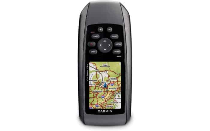
If you buy a GPS unit for your boat, the features may vary from unit to unit. Obviously, a pricier device will probably have more features. In general, however, you can expect the following.
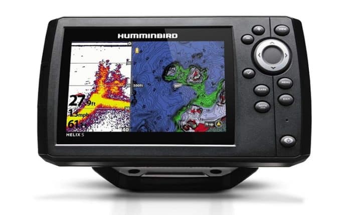
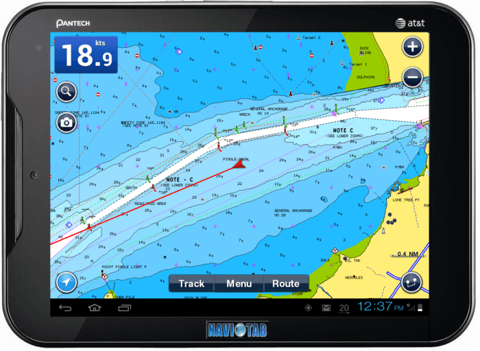
A Graphic Interface: You see this most often on your phone when you use something like Google Maps. A dedicated GPS device will also have a display screen. It should be able to offer a pretty detailed map of where you are and where you’re going. Some marine GPS devices work in conjunction with chart plotters. You can also pay for extremely detailed marine charts as well. These are ideal for painting the most accurate picture of where you are and where you’re going at sea. They include details about tides, water depth, coastal features, and more.
If you’re using your GPS at sea, you should be using charts. Not only will charts offer more info, they can be a good backup. A chart is just like a roadmap. If you’re in sight of shore, they can help find your position even if your GPS receiver fails.
Waypoints: Most modern GPS units offer waypoint ability. This is just like putting a pin on an old style paper map. They can mark where you are, where you were, and where you’re going. They can also mark every interesting thing you find along the way. A good GPS will be able to save literally thousands of waypoints. Cheaper models will not offer as many. But if you like to keep track of this kind of info, you’ll want as many as you can get.
Course Info: If you put a waypoint into your GPS, it can plot a course for you. Using the information of where you are and where you want to be, it will update constantly. This ensures you can take the fastest route to where you want to go. Or, if you have multiple waypoints, it can ensure you reach each one without getting lost.
Distance: In addition to putting you on course to your waypoint, GPS shows the distance to that point.
Speed and Time: This is one of the most valuable features of GPS. Since it is constantly measuring a user’s exact location, it is able to determine how fast you are moving. That means it calculates your speed with remarkable accuracy. In turn, that lets you know how long until you reach your destination. Since this is always being updated, you will always have accurate time data.
These points together make GPS worthwhile on its own. When you have accurate distance, course and speed info, you have an efficient boat. This can save you money by ensuring you aren’t wasting fuel. These features also ensure safety. You can avoid hazards and get ahead of things like bad weather with GPS guiding you.
Off Course Info: Your car GPS probably tells you when you have made a wrong turn. Marine GPS is similar. If you stray from the course to your waypoint, it will let you know. It will then adjust to your new position and tell you how to get back on track.
Notifications: Many GPS units can be set to have alarm notifications. These can be helpful to alert you to a number of situations. For instance, you could set an alarm to let you know when you have reached your waypoint destination. That’s a pretty basic one.
Other alerts could let you know if you’re close to another waypoint. They can also let you know if you’re leaving a waypoint. This is especially helpful if you’re fishing and have a waypoint set up where you think the fish are biting well. If you drift away, the alarm will tell you.
Autopilot: Depending on your GPS and your boat’s technology, this is another feature of note. GPS can help your vessel’s autopilot plot a course and take you where you want to go. This is an option for travelling to a waypoint when you don’t want to maintain navigation on your own.
Radar: GPS and radar can function together very well. This can help you avoid hazards in the water. With radar, GPS can make an accurate determination of what to avoid.
Maneuvering: GPS is obviously useful on the open water. What not everyone considers is its function in more close spaces. GPS is exceptionally helpful when you need to maneuver in harbors and waterways. The accuracy of GPS can keep you out of rough spots when you’re dealing with a lot of boat traffic.
GPS Apps
As the not so old saying goes, there’s an app for that. GPS has been easily incorporated into the internet of things. That means phones and other GPS devices can be connected and improved. Part of that means applications that make them more useful or efficient.
There are literally hundreds of apps you can use that make your GPS more useful. Some of them really depend on what your particular needs are, of course. But let’s take a look at some features that may grab your interest.
We mentioned earlier than charts and GPS go hand in hand. Many GPS apps are available that combine these for you. GPS manufacturers like Garmin integrate charts and other boating info with their apps. You can even get tidal data, wind speed or moon phases if you want.
NOAA charts can also be accessed with some GPS apps. These are up to date and full of valuable information.
Many apps don’t revolutionize the idea of GPS. What they do, however, is make it user friendly. It’s the difference between trying to do taxes on your own, or using some good quality tax software. It’s all the same information, but one is much easier to use.
A good GPS app has an intuitive interface. It gives you the data you want, like speed and distance, clearly. The charts are easy to read and provide what you need when you need it.
Is GPS the Best Navigation Tool?
We don’t feel like we’re taking a risk saying GPS or GNSS is the best navigation tool available to you today. But that doesn’t mean it’s the only tool. And it’s worth remembering that nothing is infallible. You should have GPS on board your boat, absolutely. But you shouldn’t rely on it as your only method of navigation. Always have a backup plan.
The fact is, GPS could potentially fail on you. In extreme weather, GPS is less reliable. If you’re out hiking, mountains or tree cover can interfere with signals. That can potentially cause serious trouble in an emergency. It’s possible that an accident could happen that renders your GPS receiver useless. If the boat capsizes, if something breaks, who knows. There are always possibilities that you should be prepared for. So what else do you have at your disposal? There are old school navigation methods you’ll want to rely on in a pinch.
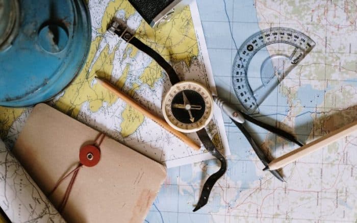
The most popular old school navigation tool is a compass. A lot of people have seen these but not all of them understand how to use one. Do yourself a favor and make sure you always have a compass in your backpack or on your boat. And not just a cell phone compass. A simple compass that can help you find magnetic north can get you out of a lot of problems when all else fails.
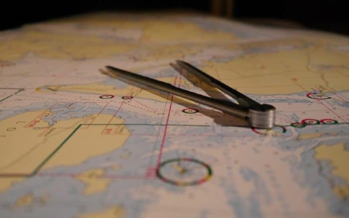
At sea or on land, old school maps are also options. Are they harder to use? You bet. Could they be out of date and missing some features? Definitely. Are they better than nothing? 100%. The entire world was navigated in a time before GPS, don’t forget. An old school map or chart can help you find features or land and direct you to safety.
Some parallel rulers or dividers are also handy here. Those are the tools ship captains used to plot courses back in the day. It worked for hundreds of years in the past and it can work today too.
In an emergency, it’s also good to have more tools handy. Obviously, on a boat, you want things like a working personal flotation device. But if your GPS fails, there are life saving tools you can have. We recommend making sure your boat has an EPIRB.
EPIRB stands for Emergency Position Indicating Radio Beacon. In an emergency, these send out a signal to rescue workers that you need help. Many marine versions are designed to float. Once activated, the signal is accurate down to an extremely small area. They are part of the Cospas-Sarsat which operates in over 200 countries. Many thousands of people have been saved by these in the past.
So while GPS is definitely a valuable tool, always be prepared. Just like you want to have a spare tire on your car for emergencies, you need a backup for GPS, too. Hopefully you won’t need it, but you’ll be glad to have it if you do.
GPS Terminology

Bearing: This is a compass direction to a (waypoint) from your present position.
Carrier Phase: This is the difference between a signal produced by your receiver and a satellite.
Differential GPS: This uses land-based radio beacons. They transmit corrections to GPS receivers. The end result is a more accurate signal.
Dual Frequency Receiver: This is a receiver that uses L1 and L2 signals.
Meridians of Longitude: These are a set of imaginary circles around the earth. They pass through the north and south poles. Longitude describes position in terms of how many degrees it is east or west of the Prime Meridian. 0° Longitude which runs through Greenwich, England).
Multipath: This is a kind of GPS ghost effect. If the signal has to travel a long way to reach an antenna, it may reflect off of surfaces. It works a bit like interference on an old TV. It can make the signal less reliable.
NAVDATA: This is the message broadcast by every GPS satellite on L1 and L2. It contains info like system time, clock correction parameters. It also includes the health of the satellite.
Navigation: This is the process of traveling from one place to another. And knowing where you are in relation to your desired course.
Parallels of Latitude: These are another set of imaginary circles that are perpendicular to the earth’s polar axis. Latitude describes position in terms of how many degrees it is north or south of the equator (0° Latitude).
PDOP: This stands for Position Dilution of Precision. This refers to a specific relationship. The one between the error in receiver position and the error in a satellite’s position.
Position: This is an exact, unique location based on a geographic coordinate system. Marine navigation is based on the latitude/longitude coordinate system.
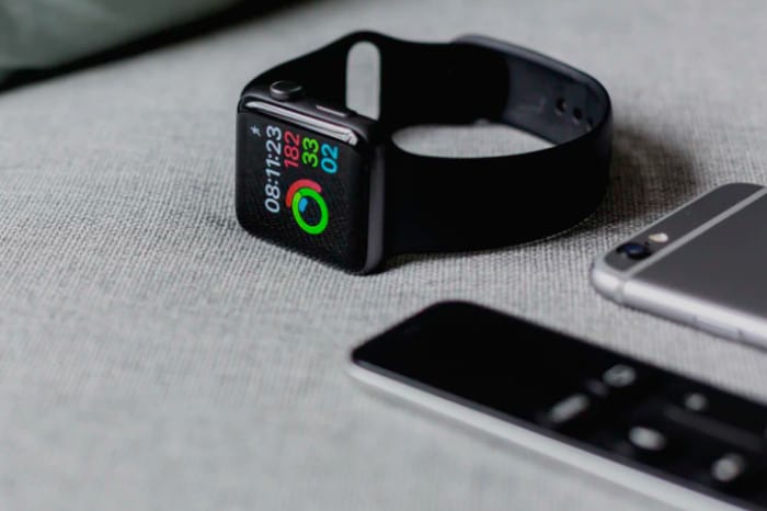
Roving Receiver: This is a way to refer to basically any GPS receiver device that moves. If it’s not stationary, like one of the base stations, it’s a rover. Your car and boat have roving receivers. A GPS watch qualifies as a roving receiver.
VRS: This is a Virtual Reference Station. It means your GPS hardware, software, and communication links. A network of stations make up the reference station to provide greater accuracy to a receiver. Basically this is a ground-based way of improving how GPS works.
WAAS: This stands for Wide Area Augmentation System. The FAA designed this for more accurate flight navigation. It uses additional satellite data to improve accuracy of GPS signals. There are two master stations and 25 ground stations that keep it working. Thanks to the improved accuracy of WAAS, GPS can narrow its accuracy to a very small area.
Waypoint: Most GPS allows you to record and save certain landmarks. These Waypoints can be looked up later if you want to see where you’ve been. They can also be used to find your way back to some place you want to go to again. A Waypoint is therefore any area of interest on your trip. It could just be your destination or your starting point. It can also be any number of spots along the way you want to remember. The amount of waypoints is only limited by the technology of your GPS receiver.
The Bottom Line
Now that you know the basics of GPS, you can appreciate it better. It is our firm belief that you should always have GPS on board any boat at sea. Its value cannot be overstated. Not just as a useful tool for fishing and recreational boating, either. Its value as a lifesaving device is unparalleled.
Twenty years ago, GPS was clunky and cost prohibitive. It offered far fewer features than it does today as well. But these days there are no excuses to not have a functional GPS. For a very reasonable price, you can have increased peace of mind at sea. The potential to keep yourself, your family, and your boat safer is real. Not to mention all the convenience benefits. Better navigation, better fishing, more fun.
Check out what GPS is available on the market today. There will definitely be something to meet your needs. As always, stay safe and have fun.
Categories: nauticalknowhow